PADDLING SUPERIOR COUNTRY BY CANOE AND KAYAK
By John Geary
Do you think we can get close enough for me to get a shot?
Sure can, said Brychan Williams, my guide and sternsman in the canoe. You just take the photo; I'll paddle us as close as we can get to the shoreline.
We squeezed in tight to the shore, inside a small island. I stopped paddling and grabbed my camera out of its dry bag to get focused on the bald eagle sitting high overhead in a fir tree.
Click-click-click!
Got'im! I said. Then I quickly put my camera back and resumed paddling from the bow.
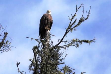
Bald eagle perched on a fir tree, high above the river.
That was just one of the highlights of a day-paddle in canoes down the Michipicoten River, in northern Ontario. In terms of bird life, we spotted more eagles, as well as several pairs of mergansers and a few kingfishers and woodpeckers while paddling downstream.
I was adventuring out of the lodge owned and run by Naturally Superior Adventures. The Michipicoten flows into the greatest of all the Great Lakes, Lake Superior, just a few klicks north of the northern boundary of Lake Superior Provincial Park. The lodge sits right at the mouth of the river where it becomes the lake.
There are plenty of paddling options in the area, both for canoeing and kayaking. While staying there, I spent one day canoeing on the river, the second day kayaking on what Gordon Lightfoot referred to as the big lake they call Gitche Gumee, in his popular song.
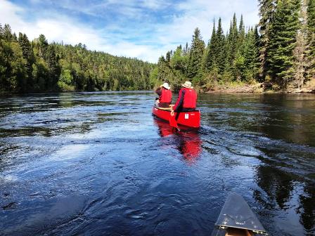
Paddling downstream on the Michipicoten.
The area boasts a rich history far beyond Lightfoot's ballad. This river was part of the original water route used by fur traders to access the interior. It's thought that Pierre-Esprit Radisson and Médard des Groseilliers - the men chiefly responsible for the formation of the Hudson's Bay Company (HBC) - were the first non-natives to travel this route. The HBC and the Northwest Company competed fiercely for the furs in the area; we paddled past the spots where both companies had established trading posts near the mouth of the river. We didn't see much in the way of evidence left from those bygone days, though. The HBC post was abandoned almost 120 years ago.
However, we did catch a view of gorgeous Silver Falls, a waterfall created where the Magpie River flows into the Michipicoten not far from its mouth. That was the second set of falls we viewed that day, as we'd put in just below Scott Falls upriver at the start of our adventure.
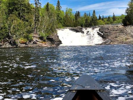
Silver Falls seen from the bow of the canoe.
It was a very nice half-day paddle with the current, although when we got close to the mouth of the river where we would take out, we did have to paddle harder due to the wind and waves from the lake pushing into our faces.
The next day, we traded in our canoes for sea kayaks. We put into the river where we had taken out the day before, then paddled our kayaks out into the lake and around the point where the lodge sat. Our destination was Sandy Beach, a spot along Michipicoten Bay that we visited the day before by land in order to check out the interpretive sign about A.Y. Jackson, one of the members of the Group of Seven. He apparently painted one of his iconic shoreline paintings from that beach. Finding a beach like that is not easy along the Lake Superior shoreline, which tends to be very rugged.
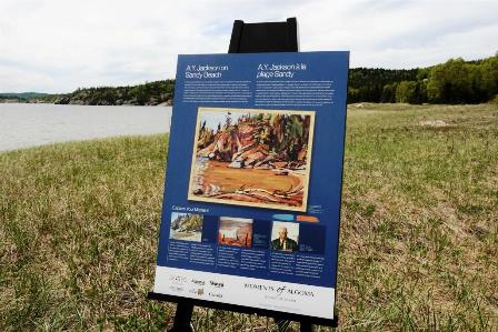
Interpretive sign on Sandy Beach.
There are other interpretive signs throughout the park of which the beach is part, explaining more of the history and the ecology of the area.
Both paddling there and paddling back, we enjoyed the company of more mergansers, a couple of common loons and a whole rocky island full of gulls as we neared the beach.
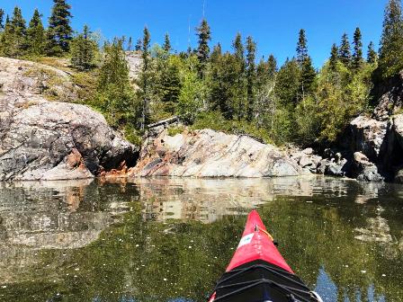
Much of the coast of Lake Superior is rocky and rugged.
As we finished our second half-day trip and paddled back into the mouth of the river at the end of our journey, I spotted a merganser in the same place I saw one as we were leaving. I wondered if it was the same bird, and if it had even moved from that spot? Maybe it was a good fishing spot to try but that's another story, another adventure for another time.
IF YOU GO: Naturally Superior:https://www.naturallysuperior.com/ provided the guides and gear for our day trips and dished up tasty, hearty fare for meals at the lodge. They run day trips as well as several extended multi-day trips in the area. The two trips we paddled were suitable for people of all paddling levels you don't have to be an expert to enjoy them.
While there, be sure to visit the iconic Canada Goose statue in the town of Wawa, just five kilometres away by car. There are actually three different giant goose statues in Wawa. The main one sits by a visitor centre and is surrounded by panels painted with people who've played prominent roles in local history.
Experience Wawa:https://www.experiencewawa.com/ can provide more info about that and provide ideas for other adventures (waterfall viewing!) in the area. The closest large city with an airport is Sault Ste. Marie:http://saulttourism.com/ a 2-1/2 hour drive along the Trans-Canada Highway.
Another good source for info is AlgomaCountry: https://www.algomacountry.com/
PHOTOS: by John Geary